1 thought on “that’s a-FRICAn large continent to hold all this”
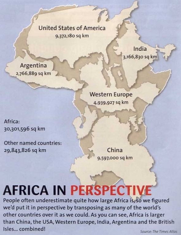
The problem is that wall maps are out of perspective to a (more or less) spherical body–but nobody notices the lines of latitude and longitude are not equidistant apart on said map.
If you look at a globe, then you can see how big Africa is.
Comments are closed.
Cookie Consent
We use cookies to improve your experience on our site. By using our site, you consent to cookies.


The problem is that wall maps are out of perspective to a (more or less) spherical body–but nobody notices the lines of latitude and longitude are not equidistant apart on said map.
If you look at a globe, then you can see how big Africa is.